L’articolo è stato aggiunto alla lista dei desideri
LIBRO INGLESE

 E-mail
 Facebook
 LinkedIn
 Twitter
 WhatsApp
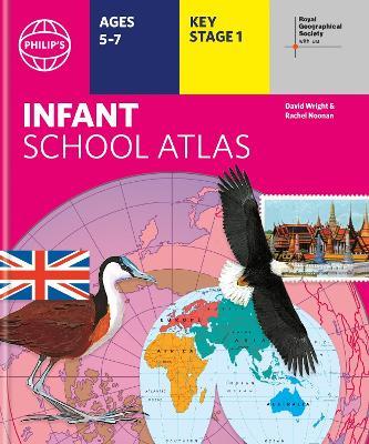
Philip's RGS Infant School Atlas
(0)
Cliccando su “Conferma” dichiari che il contenuto da te inserito è conforme alle Condizioni Generali d’Uso del Sito ed alle Linee Guida sui Contenuti Vietati. Puoi rileggere e modificare e successivamente confermare il tuo contenuto. Tra poche ore lo troverai online (in caso contrario verifica la conformità del contenuto alle policy del Sito).
Grazie per la tua recensione!
Tra poche ore la vedrai online (in caso contrario verifica la conformità del testo alle nostre linee guida). Dopo la pubblicazione per te +4 punti ![]()
10,68 €

-5%
11,24 €
+110
punti
Venditore: IBS
Articolo acquistabile con Carta del Docente

Articolo acquistabile con Carta Cultura Giovani e Carta del Merito

Dati e Statistiche
 Salvato in 0 liste dei desideri
Philip's RGS Infant School Atlas
Disponibile in 5 giorni lavorativi
10,68 €
-5%
11,24 €
10,68 €
11,24 €
-5%
Disp. in 5 gg lavorativi

Philip's RGS Infant School Atlas
Libri in Inglese
Altri venditori
Prezzo e spese di spedizione

Venduto e spedito da IBS
10,68 €
Spedizione gratuita
Altri venditori
Prezzo e spese di spedizione
Venduto e spedito da IBS
10,68 €
Spedizione gratuita
Altri venditori
Prezzo e spese di spedizione
Tutti i formati ed edizioni

Promo attive (1)
Written for 5 to 7 year-old this atlas is ideal for teaching Key Stage 1, helping to cover geography, history, science, citizenship and literacy requirements - Written by experts Professor David Wright and Rachel Noonan - Published in association with the Royal Geographical Society - 50 pages of clear, child-friendly maps showing our world today - Countries of the world brought to life with flags, illustrations and photos - Bold text, simple words and short sentences to encourage reading skills - Starts with the Earth as a Planet then zooms into each of the world's regions with maps and illustrations - Numbered balloons on each map link to photos of a real place Fully revised and updated, the atlas is for children aged 5-7 in the early stages of reading, with simple text to explain what is happening on the maps and illustrations - all compatible with National Curriculum Key Stage 1. Clear, child-friendly maps are combined with vibrant photographs and facts about the world to provide essential geographical information for young children. Guidance is given at the beginning of the atlas on how to use the maps, encouraging the early development of map skills and knowledge of the world. Each colourful spread is illustrated with photographs and packed with fact boxes, curiosities, flags, stamps and simple quiz questions. Philip's RGS Infant School Atlas is both fun to use and easy to understand. The text is simple and uncomplicated to encourage early reading skills.
Leggi di più
Leggi di meno
Autore:
Editore:
Collana:
Philip's World Atlas
Anno:
2021
Rilegatura:
Hardback
Pagine:
48 p.
Testo in English
Dimensioni:
294 x 244 mm
Peso:
520 gr.
EAN:
9781849075848
L'articolo è stato aggiunto al carrello
L’articolo è stato aggiunto alla lista dei desideri