L’articolo è stato aggiunto alla lista dei desideri
LIBRO INGLESE

 E-mail
 Facebook
 LinkedIn
 Twitter
 WhatsApp
Philip's Navigator Street Atlas Wiltshire and Swindon
(0)
Cliccando su “Conferma” dichiari che il contenuto da te inserito è conforme alle Condizioni Generali d’Uso del Sito ed alle Linee Guida sui Contenuti Vietati. Puoi rileggere e modificare e successivamente confermare il tuo contenuto. Tra poche ore lo troverai online (in caso contrario verifica la conformità del contenuto alle policy del Sito).
Grazie per la tua recensione!
Tra poche ore la vedrai online (in caso contrario verifica la conformità del testo alle nostre linee guida). Dopo la pubblicazione per te +4 punti ![]()
20,18 €

-5%
21,24 €
+200
punti
Venditore: IBS
Articolo acquistabile con Carta del Docente

Articolo acquistabile con Carta Cultura Giovani e Carta del Merito

Dati e Statistiche
 Salvato in 0 liste dei desideri
Philip's Navigator Street Atlas Wiltshire and Swindon
Disponibile in 5 giorni lavorativi
20,18 €
-5%
21,24 €
20,18 €
21,24 €
-5%
Disp. in 5 gg lavorativi

Philip's Navigator Street Atlas Wiltshire and Swindon
Libri in Inglese
Altri venditori
Prezzo e spese di spedizione

Venduto e spedito da IBS
20,18 €
Spedizione gratuita
Altri venditori
Prezzo e spese di spedizione
Venduto e spedito da IBS
20,18 €
Spedizione gratuita
Altri venditori
Prezzo e spese di spedizione
Tutti i formati ed edizioni

Promo attive (0)
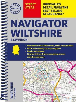
The only county Street Atlas with all the named streets of Wiltshire and Swindon and perfect back-up for emergency services, delivery drivers, visitors and locals. With more than 13,000 named streets, roads, lanes and alleys, this is the essential map book for residents and visitors - especially if you're in a hurry. Includes all the streets in CHIPPENHAM, DEVIZES, MARLBOROUGH, SALISBURY, SWINDON, TROWBRIDGE, Warminster, Amesbury, Avebury, Bradford-on-Avon, Burbage, Calne, Corsham, Cricklade, Durrington, Frome, Great Bedwyn, Highworth, Hungerford, Lambourn, Larkhill, Lechlade-on-Thames, Little Bedwyn, Ludgershall, Lyneham, Malmesbury, Melksham, Mere, Pewsey, Purton, Royal Wootton Bassett, Shaftesbury, South Cerney, Stourton, Tidworth, Westbury, Wilton. - New completely revised edition in practical spiral-bound format - Street maps show car parks, schools, hospitals and many other places of interest, including off the beaten track - 4-page practical route-planning section showing all A and B roads - Super-clear mapping - Easy-to-use index - Scales: 1¾ inches to 1 mile (1:36,000) and 3½ inches to 1 mile (1:18,000). Other information on the maps includes postcode boundaries, car parks, railway and bus stations, post offices, schools, colleges, hospitals, police and fire stations, places of worship, leisure centres, footpaths and bridleways, camping and caravan sites, golf courses, and many other places of interest.
Leggi di più
Leggi di meno
Autore:
Editore:
Collana:
Philip's Street Atlas
Anno:
2024
Rilegatura:
Spiral bound
Pagine:
256 p.
Testo in English
Dimensioni:
268 x 190 mm
Peso:
560 gr.
EAN:
9781849076395
L'articolo è stato aggiunto al carrello
L’articolo è stato aggiunto alla lista dei desideri