L’articolo è stato aggiunto alla lista dei desideri
LIBRO INGLESE

 E-mail
 Facebook
 LinkedIn
 Twitter
 WhatsApp
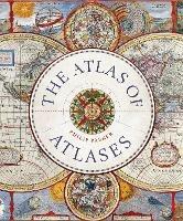
The Atlas of Atlases: Exploring the most important atlases in history and the cartographers who made them
(0)
Cliccando su “Conferma” dichiari che il contenuto da te inserito è conforme alle Condizioni Generali d’Uso del Sito ed alle Linee Guida sui Contenuti Vietati. Puoi rileggere e modificare e successivamente confermare il tuo contenuto. Tra poche ore lo troverai online (in caso contrario verifica la conformità del contenuto alle policy del Sito).
Grazie per la tua recensione!
Tra poche ore la vedrai online (in caso contrario verifica la conformità del testo alle nostre linee guida). Dopo la pubblicazione per te +4 punti ![]()
27,71 €

-5%
29,17 €
+280
punti
Venditore: IBS
Articolo acquistabile con Carta del Docente

Articolo acquistabile con Carta Cultura Giovani e Carta del Merito

Dati e Statistiche
 Salvato in 0 liste dei desideri
The Atlas of Atlases: Exploring the most important atlases in history and the cartographers who made them
Disponibile in 5 giorni lavorativi
27,71 €
-5%
29,17 €
27,71 €
29,17 €
-5%
Disp. in 5 gg lavorativi

The Atlas of Atlases: Exploring the most important atlases in history and the cartographers who made them
Libri in Inglese
Altri venditori
Prezzo e spese di spedizione

Venduto e spedito da IBS
27,71 €
Spedizione gratuita
Altri venditori
Prezzo e spese di spedizione
Venduto e spedito da IBS
27,71 €
Spedizione gratuita
Altri venditori
Prezzo e spese di spedizione
Tutti i formati ed edizioni

Promo attive (0)
This beautiful book is a lavishly illustrated look at the most important atlases in history and the cartographers who made them. Atlases are books that changed the course of history. Pored over by rulers, explorers and adventures these books were used to build empires, wage wars, encourage diplomacy and nurture trade. Written by Philip Parker, an authority on the history of maps, this book brings these fascinating artefacts to life, offering a unique, lavishly illustrated guide to the history of these incredible books and the cartographers behind them. All key cartographic works from the last half-millennium are covered, including: The Theatrum Orbis Terrarum, considered the world's first atlas and produced in 1570 by the Dutch, geographer Abraham Ortelius. The 17th-century Klencke - one of the world's largest books that requires 6 people to carry it The Rand McNally Atlas of 1881, still in print today and a book that turned its makers, William H Rand and Andrew McNally into cartographic royalty. This beautiful book will engross readers with its detailed, visually stunning illustrations and fascinating story of how map-making has developed throughout human history.
Leggi di più
Leggi di meno
Autore:
Editore:
Collana:
Liber Historica
Anno:
2022
Rilegatura:
Hardback
Pagine:
272 p.
Testo in English
Dimensioni:
196 x 235 mm
EAN:
9780711268050
L'articolo è stato aggiunto al carrello
L’articolo è stato aggiunto alla lista dei desideri